Crane's Nest Wash Trail is located in Lake Mead NRA. Turn southwest at the 8 mile marker across the Hoover Dam Bridge in Arizona.
Drive southwest through the gravelly wash for about 4 miles to the marked campground. Although there is no sand, the gravel can be quit deep and a 4WD vehicle is necessary. There are very few places to pull off the single lane road and no where to turn around until you get to the camp ground unless you have 4WD.
Devil's Post piles can be seen on the right as soon as you enter the wash.
This castle-like formation appears on the left as you walk down the wash. It is located about two miles down the wash from the highway.
Another castle-like formation located just before you enter the deep part of the canyon.
A pour over at the beginning of the deeper part of the canyon.
The canyon is deep and magical for about a mile before you reach Lake Mohave.
Many of the rock formations seem to be standing on their sides like they were lifted up at a 90 degree angle.
Add caption
Deeper part of the canyon.
Tamarisk Trees at the lake.
Lake Mohave
Sitting on the shore of Lake Mohave at the end of the trail.
Fortification Hill from Kingman Wash Road. The Trail is on the backside of the Mesa.
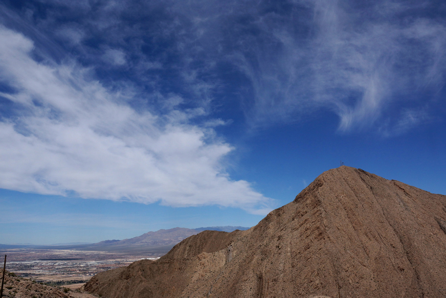
Fortification Hill is a steep hike up the ridge of a hill to the base of the mesa wall where you make a short scramble over the wall to the top of the mesa. At the top you can see Lake Mead, the bridge over the Colorado River, Boulder city and much Las Vegas.
To get to the trail head take exit 2 to Kingman Wash Road just over the bridge on the Arizona side. Travel 4 miles until you see the outhouse. Turn right towards the outhouse and take the road to the right another 2 miles. Keep going until you see the trailhead sign and parking area. The road is a bit rough and 4-wheel drive is recommended, but a car would be able to navigate it.
The trail follows the ridge up to the base of the rock wall surrounding the mesa.
The trail starts ascending at the very beginning. Climb up the ridge to the right or take the wash to the left of the ridge until it meets up with the ridge trail about half way up.
There is a short scramble at the base of the mesa.
Once you get to the rock wall there is a short scramble that isn't difficult up over the ridge.
Helicopters fly by taking tourist to the Grand Canyon.
The view from the top of the mesa is spectacular! Helicopters fly through the valley below taking tourists to the Grand Canyon.
View of the mountains to the south
View of Lake Mead, Bridge over the Colorado River, Boulder City and Las Vegas from the top of Fortification Hill
This is a very steep and treacherous trail. You climb 1,788 feet from the bottom on a dirt road littered by large gravel. You have to watch every step you take, and it is very easy to slide. Take a hiking stick to help keep your balance. The trail head is 6.6 miles from the park entrance on Lake Mead Blvd or 2.1 miles from Hollywood Blvd. The views are spectacular. You can see all of Las Vegas and Henderson if you go out on the far summit.
This is not actually on the Frenchman Trail, but is a wash not far from the trail.
Oak Creek Canyon Trail is the last trail on the loop road of Red Rock Canyon. Drive the short dirt road to the trail head. The trail goes towards the canyon for about a mile, then you have to make your way up the canyon through large boulders. Some of the trail is marked, but most you just try to find the easiest way around and over the boulders.
This beautiful, short hike is in Henderson, NV. Hike a mile to the start of the canyon from the River-Mountain Bike trial. You will see steep cliffs that bighorn's love to hang out on, huge boulders that you can crawl under, and beautiful views towards Lake Las Vegas, Henderson, and Las Vegas.
To get to this canyon from Racetrack Road in Henderson, turn towards the desert on Essex Ave. Keep on the road until it turns into a dirt road and comes to a parking area next to the River-Mountain Bike Path. The canyon is basically straight back over the hill towards Lake Mead. You can take the road behind the water tank and then turn right into the wash before the second water tank. Follow the wash to to the canyon.
Arrow Canyon is a very interesting hike. The steep, slanted and sometimes curved walls makes it a unique place. You will see canyon walls scattered with barrel cactus, petroglyphs, and trees growing out of cracks in the rock walls. If you take this hike early in the season, February and March, you will see the bottom of the canyon covered in green grass in many areas. This is a great place to see bighorn sheep so keep your eyes out for them on the steep cliffs.
Caution: Although this hike is fairly flat with very little elevation gain, I found it to be quite difficult because of the small and large rocks littering the bottom of the canyon. It is slow walking because you have to be careful where you place your feet. You have to stop a lot to look around because you really can't look while you are walking or you will trip and fall.
To get here take Interstate 15 to the Moapa, Exit 90 about 53 miles from Henderson less from Las Vegas. Drive up Highway 168 about 19 miles until you see the entrance to Arrow Canyon Access Road. There is no sign next to the road. It is the dirt road right after Warm Springs Road. It looks like an entrance to a ranch. You will see the sign after turning onto the road.
This access road starts our great but you must bear right onto the dirt road after only a short distance. It doesn't look much like a road, but it isn't too bad to the first parking area. The road after the first parking area is quite bumpy and in some places very uneven. Don't take it if you don't have a high clearance four-wheel drive vehicle. The first parking lot is about a mile from the second one, so you will be adding two miles to your hike, but it is worth not destroying your vehicle or getting stuck in the sand and having to pay for a tow.
Bootleg Canyon - POW and Mother Trail - Boulder City, NV
Bootleg Canyon is only 30 minutes from Henderson, NV in Boulder City. You can actually hike the trails that start in Henderson and hike up to Boulder city. These are mountain bike trails and you must watch out for bikers and get off the trail so they can pass. Also try not to knock rocks down into the trails because they can be hazardous to bikers.
I started this hike at the trailhead near the Veterans Memorial Hospital. I followed the POW trail to the Mother trail going towards and behind the golf course which took about an hour to an hour and a half because I stopped a lot for pictures. I found a lone bighorn that didn't seem afraid of my presence. I was able to film it with my long lens with no problem. The bighorn sheep have been experiencing a decline because a pneumonia virus. This may be why this ewe seemed to be all by herself. The footage and stills were all filed within the three hours that I was on the trail this morning.
Hidden Canyon (this is what I call it) is located less than a mile from the River Mountain Bike Trail. In less than thirty minutes of walking you will feel like you have walked into a desert wilderness except for the constant airplanes overhead. You will find huge boulders as big as building. One of the boulders you can walk under.
Be aware when walking this trail. It is perfect coyote and mountain lion country. A mountain lion was spotted in this area.
The hike to this grotto takes less than half an hour and is a short distance from the paved bike trail by Terrazzo Park in Lake Las Vegas. Park in the Terrazza Park parking lot and walk down the bike path towards the bridge over the wash. Walk over the bridge and up the hill until you see a dirt path going off to the right. The path is marked with cairns and go down and back up through some washes. The trail leads up and around the hill into a canyon where it leads to the grotto. The hikes is best in the morning because the sun shines up through the canyon. If you go in the evening the canyon will be shaded by the walls of the canyon. If it is a hot day stop at the wash to cool off. You can walk down to the wash if you make a right hand turn on the dirt road right before the bridge. Right after the sign for the Wetlands Park you can walk down into the wash next to the weir (small damn).
This coyote scared the heck out of me when I was taking pictures in the desert with my dogs. We weren't far from the horse corals. You can see part of the River Mountain Water Treatment Facility in the background.